I will simulate the ash dispersal from Eyjafjallajokull using HYSPLIT. By simulating the ash dispersal during different times in the year I hope to determine the ash dispersal variation given different atmospheric circulation patterns.
Eyjafjallajokull Background Info
| Country | Latitude | Longitude | Elevation | Eruption Date |
|---|---|---|---|---|
| Iceland | 63.633 degrees North | 19.633 degrees West | 1651 m | April 14, 2010 |
Plume Height

Image 1:
Source: NASA, https://www.nasa.gov/topics/earth/features/iceland-volcano-plume-archive1.html
Ash Dispersal

Image 2:
Source: NASA, https://www.nasa.gov/topics/earth/features/iceland-volcano-plume-archive1.html
HYSPLIT Simulations for Eyjafjallajokull (Varying Eruption Date)
By simulating Eyjafjallajokull for various eruption dates, I sought to investigate how the circulation patterns changed both seasonally and weekly and whether the seasonal versus weakly variations dominated the ash dispersal patterns. Simulations showed that the weekly changes in atmospheric circulation patterns dominated any seasonal trends. Eyjafjallajokull sits at the boundary between two different air masses (between the polar and eddy regimes--air nearer to the poles is generally cold and dry whereas at mid-latitudes it is warmer and also influenced by the tropics). This region is influenced by the North Atlantic Oscillation (NAO) phenomenon in which the circulation patterns vary dramatically.
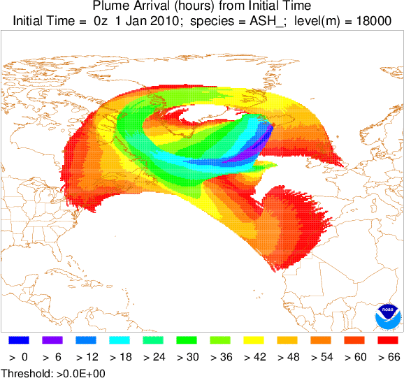
The pronounced weekly variation in the ash dispersal may result from the varying eddies that pass by the region of the volcano. The eddies are mesoscale (order of 1000 km), and thus which eddy occupies the region during the eruption would serve as the main determinant of the ashes' dispersal. Moreover, the local variance has significant downstream effects. In simulation for the eruption on January 1, 2010, the ash reached the U.S. whereas in the simulation a week later on January 8, 2010, the ash reached Russia.
In order to understand over what time periods the ash dispersal would vary, one must look into the time scales of the eddys in the Icelandic region. Further simulations should explore variations in dispersal from daily changes to the eruption date.
April 14-16, 2010
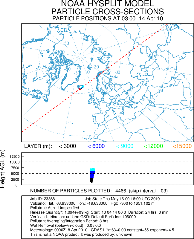
Image 3: 3-day ash dispersal simulation for Eyjafjallajokull for actual eruption date of April 14, 2010. The plume initially moves north-eastward and then south-westard. As the plume moves northward it deflects to the east and as it moves southward it deflects to the west as predicted by the rightward deflection of the coriolis force in the northern hemisphere. The two layers closest to the Earth's surface spread the furthest.
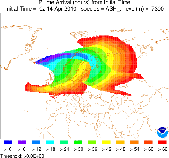
Image 4: 3-day Ash dispersal by arrival time for Eyjafjallajokull for actual eruption date of April 14, 2010. Shows that the plume either moves northeastward or southwestward.
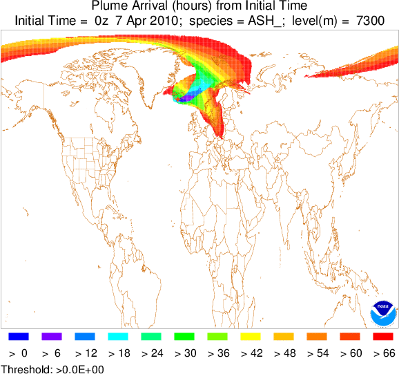
April 7-9, 2010
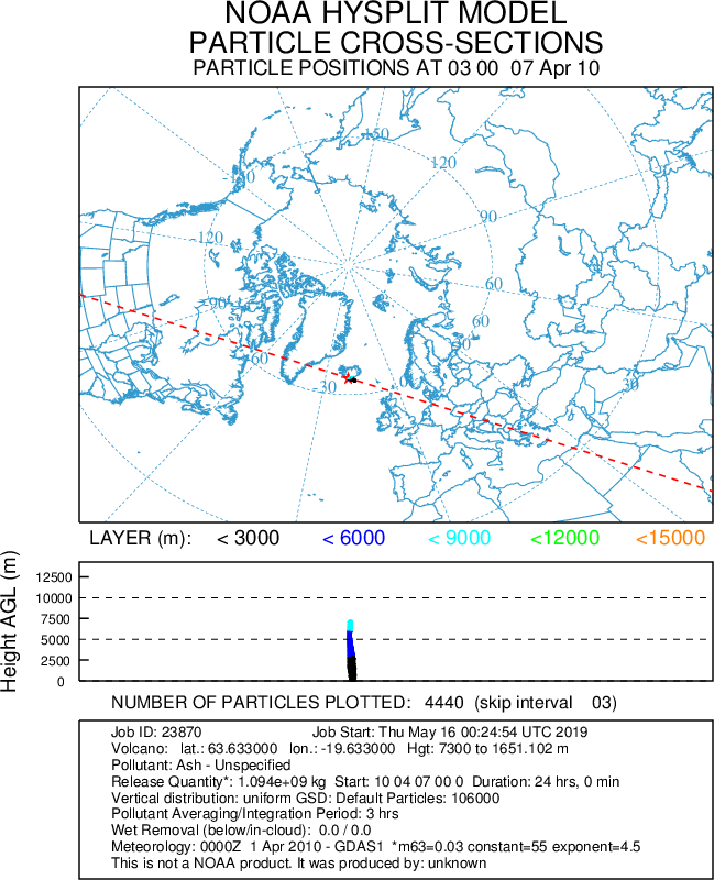
Image 5: 3-day ash dispersal simulation for Eyjafjallajokull for eruption date of April 7, 2010, a week earlier from its actual eruption date. The plume initially moves north-eastward and then south-westard. As the plume moves northward it deflects to the east and as it moves southward it deflects to the west as predicted by the rightward deflection of the coriolis force in the northern hemisphere. As opposed to the dispersal for the prior week, part of the northward plume was swept into the polar regime. In contrast to what we would expect from theoretical predictions, the plume in the polar region moved clockwise when due to the coriolis force in the northern hemisphere, we would have anticipated it to move cyclonically.
January 1-3, 2010
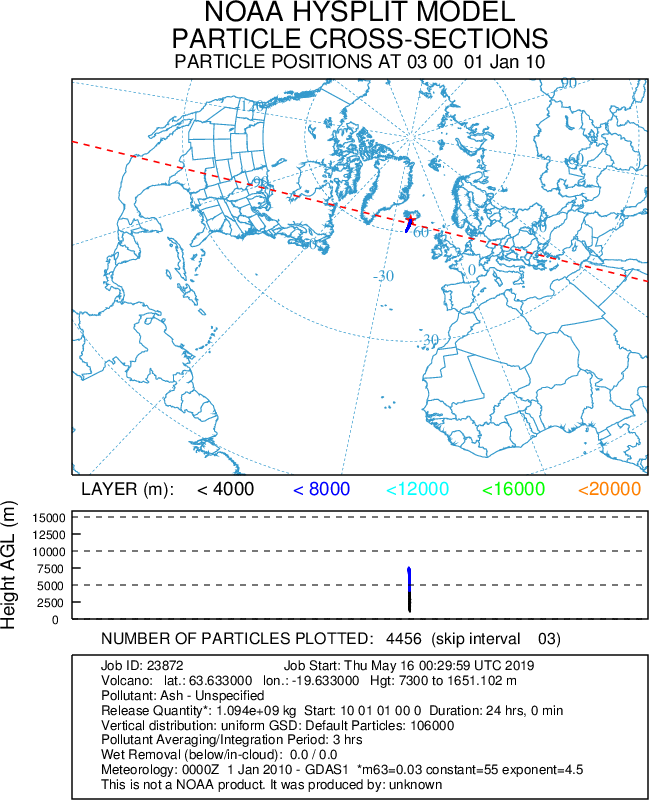
Immediately moves anticyclonically in conflict with what theory would predict about the mean flow near the north pole where the Earth's rotation has a strong influence. Additionally, the plume that moves southward deflects to the east rather than the west as the right-ward deflection from the coriolis force would predict.
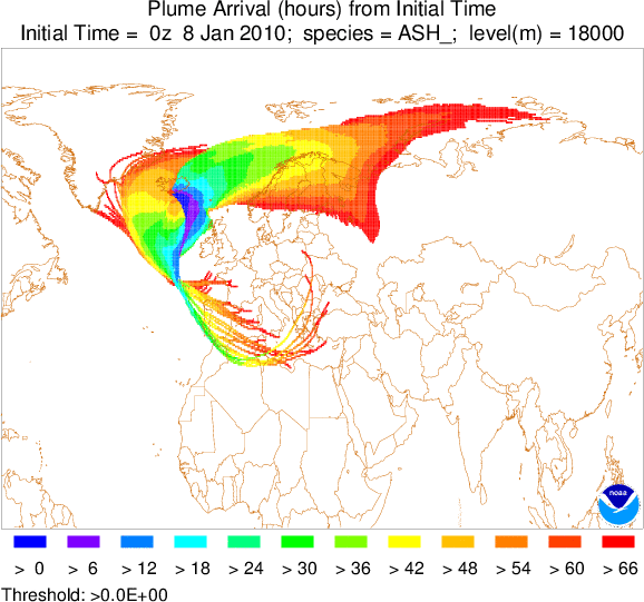
January 8-10, 2010
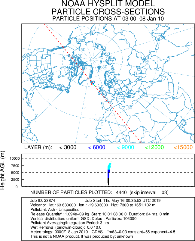
ultimately plume moves towards pole both in cyclonic and anticyclonic spirals
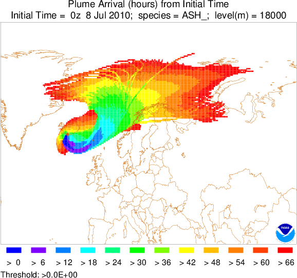
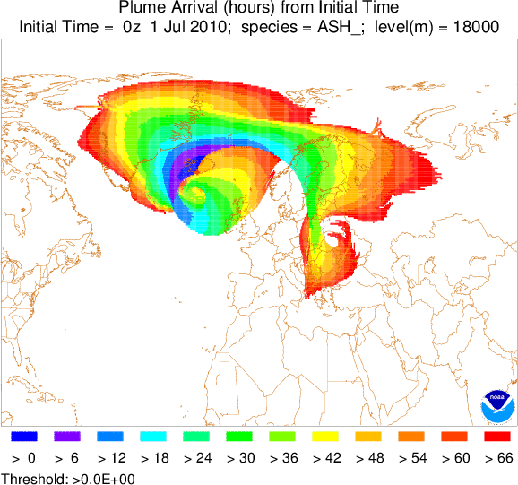
July 1-3, 2010

northward and anti-cyclonically
July 8-10, 2010
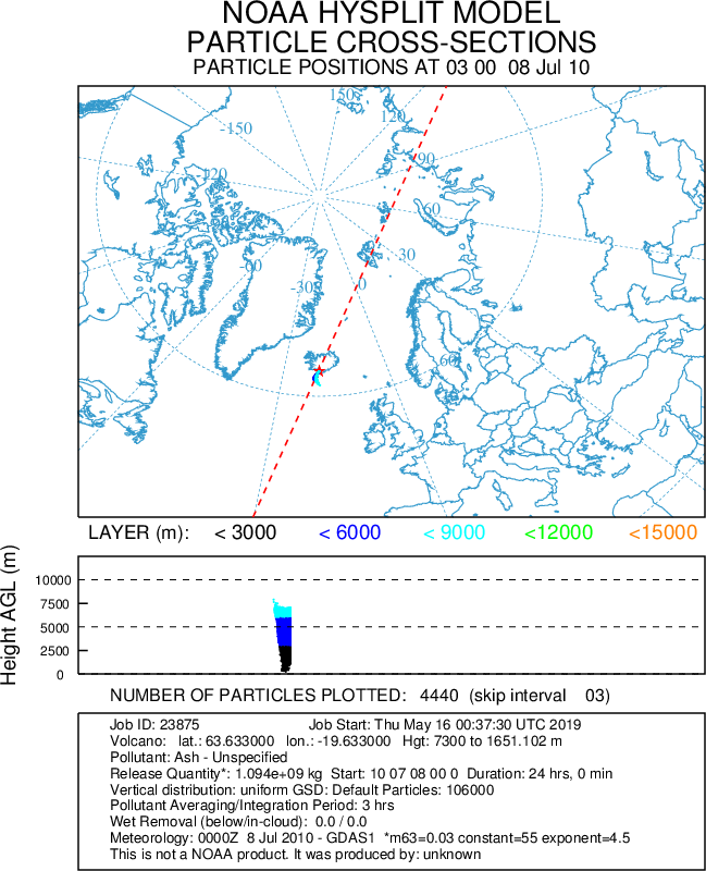
moves poleward cyclonically.